
Construction errors cost millions every year. You waste time redoing work, sorting RFIs, and scrambling to keep schedules on track. Drone mapping flips that script with precise aerial maps that capture your site’s true shape and progress. With orthomosaics and 3D models tailored for construction, you’ll spot issues before they become costly mistakes. Ready to see how this technology changes your project’s outcome? Learn more in this insightful article: https://rekon.ca/aerial-mapping-in-construction/.
Drone Mapping in Construction
Drone mapping is charting new territories in construction. By using orthomosaics, 3D models, and aerial maps, you gain a clearer, more accurate view of your projects. Let’s delve into how each of these tools can transform your construction operations.
Enhancing Accuracy with Orthomosaics
Orthomosaics provide an exact picture of the construction site. These detailed maps eliminate guesswork. By taking numerous aerial photos and stitching them together, orthomosaics create a reliable, up-to-date map of your site. You can easily identify discrepancies between plans and reality. This accuracy leads to better decision-making and fewer on-site surprises.
Imagine catching an error before it turns into a costly rework. That’s the power orthomosaics bring. You see the current state of things and can compare it against your planned layout. It’s like having a bird’s-eye view that never lies.
Reducing Errors with 3D Models
3D models offer a virtual replica of your site. These models are invaluable in spotting potential issues early. Envision walking through your project without leaving your office. You can identify problems with the design or structure before they become expensive mistakes. This proactive approach saves time and money.
By seeing the project in 3D, you gain insights that flat plans can’t offer. You’re able to visualize spaces and structures from multiple angles. This new perspective is key to preventing errors and maintaining quality control.
Progress Tracking with Aerial Maps
Keeping track of progress is crucial in construction. With aerial maps, you get real-time## Drone Mapping in Construction
Drone mapping is transforming how construction sites are managed and monitored. It brings precision and insight, reducing the guesswork that often leads to costly mistakes.
Enhancing Accuracy with Orthomosaics
Orthomosaics are like supercharged maps for your projects. They offer a high-resolution, top-down view of your site. By using orthomosaics, you can identify misalignments early and keep everything on track. These maps are created from drone imagery, stitched together to produce comprehensive views. This way, you get consistent and accurate visuals. The precision of orthomosaics helps in verifying layout alignments, ensuring that plans are followed precisely. This technology gives you a clear snapshot of your site, making it easier to catch errors before they escalate. With these detailed maps, you can achieve a level of accuracy that traditional methods struggle to match.
Reducing Errors with 3D Models
3D models provide a dynamic view of your construction site. They allow you to visualize elevations and structures in real-time. By seeing your project in 3D, you can spot potential issues that might not be visible in 2D plans. These models are invaluable for verifying the design against actual construction. You can walk through the site virtually, checking every corner for compliance with the plans. This proactive approach ensures that your project flows smoothly, minimizing surprises. Using 3D models, you improve communication with stakeholders by offering them a clear representation of the project’s status.
Progress Tracking with Aerial Maps
Aerial maps are your eyes in the sky. They provide regular updates on your site’s progress, helping you stay informed. By comparing these maps over time, you can track changes and assess if everything is progressing as planned. This method keeps everyone aligned on the project’s timeline. It also helps in identifying delays early, allowing for timely interventions. Aerial maps are not just about tracking; they are about maintaining control over your project. With regular aerial insights, you can ensure that the project stays on schedule and within budget.
Benefits of Drone Technology
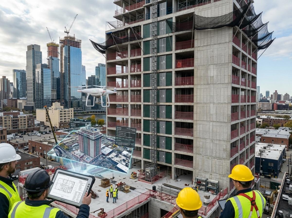
Drone technology offers various benefits that directly impact your project’s success. It streamlines processes and delivers results that improve overall site management.
Cutting Rework and RFIs
Drone mapping helps reduce the need for rework and RFIs by providing precise data. When you have accurate maps and models, there’s less room for misunderstanding. This clarity means fewer requests for information, allowing your team to focus on what matters. The result is a smoother workflow with less back-and-forth, saving time and resources. By cutting down on rework, you also reduce waste, making your project more efficient.
Preventing Change Orders
Change orders can be a project’s bane, often leading to increased costs and delays. Drones help prevent these by offering detailed site analysis. With up-to-date aerial data, you can identify potential changes before they become issues. This proactive approach means fewer surprises and more predictable project outcomes. You maintain control over your budget and timeline, ensuring that changes are necessary and justified.
Improving Quality Control
Quality control is crucial in construction, and drones elevate this process. With precise aerial imagery, you can conduct regular inspections and verify that standards are met. This oversight ensures that every part of your project meets the required specifications. Drones provide a level of detail that enhances traditional quality checks, offering a comprehensive overview that is both accurate and reliable.
Drone Mapping for Site Monitoring
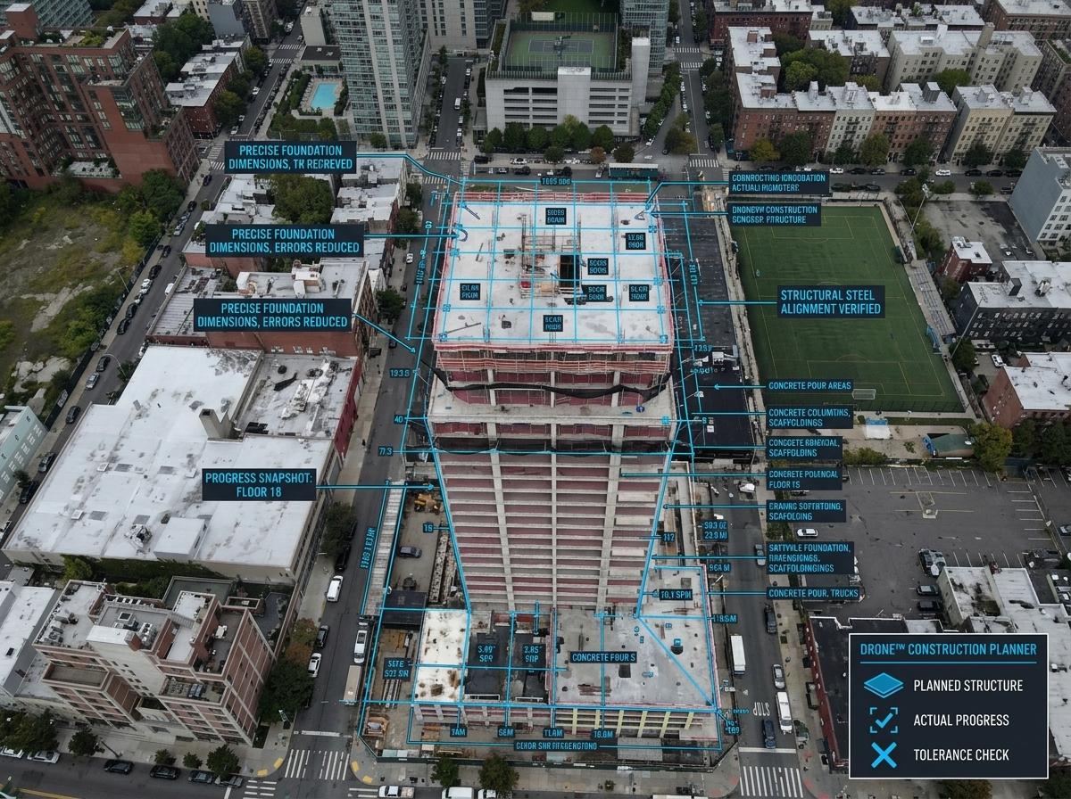
Drones are revolutionizing site monitoring by providing comprehensive data that informs decision-making. They offer insights that keep your project on track and within scope.
Georeferenced Imagery and BIM Workflows
Georeferenced imagery ties your maps to real-world coordinates, enhancing accuracy in planning. This data integrates seamlessly with BIM workflows, offering a powerful tool for project management. By combining drone imagery with BIM, you create a dynamic model that evolves with your project. This integration fosters collaboration and ensures that everyone works from the same, updated information, reducing errors and improving efficiency.
As-Built Verification and Documentation
Drones simplify as-built verification by providing up-to-date visuals of your site. These visuals serve as documentation that verifies construction against design plans. With drones, you capture the true state of your project, ensuring compliance with specifications. This documentation is invaluable for stakeholders, offering a reliable record of progress and adherence to plans.
Volumetric Calculations and Cut and Fill Analysis
Volumetric calculations are made easy with drones. By analyzing aerial data, you accurately measure material volumes for cut and fill analysis. This precision aids in planning and resource management, ensuring efficient use of materials. With drones, you gather the data needed for these calculations quickly and accurately, saving time and reducing manual errors. This capability enhances decision-making, leading to better project outcomes.
Frequently Asked Questions
What is drone mapping in construction?
Drone mapping in construction involves using drones to capture aerial images and data, which are then processed into maps, models, and insights that aid site management.
How do drones improve quality control in construction?
Drones offer detailed aerial imagery that allows for regular site inspections, ensuring that construction meets quality standards and specifications.
What are the benefits of using 3D models in construction?
3D models provide a dynamic view of the site, helping visualize and verify the design against what is being built, reducing errors, and improving planning accuracy.
Learn the advantages of precision mapping for your projects.