
Most real estate teams still rely on outdated site surveys that slow every step—from land acquisition to permitting. Orthomosaic mapping changes the game with precise, high-resolution drone maps that bring your site to life. In this post, you’ll see how these detailed aerial images speed up planning, zoning, and marketing while giving your team a clear edge. Ready to explore the benefits of orthomosaic drone maps in real estate development? Learn more here.
Accelerating Site Planning and Design
Orthomosaic drone maps are revolutionizing the way real estate teams approach site planning and design. They empower you to make faster and more informed decisions, offering a bird’s-eye view of your potential site.
Orthomosaic Mapping for Site Selection
Orthomosaic mapping provides a comprehensive view of large areas, perfect for site selection. These maps capture every detail with high accuracy, ensuring you don’t miss important features. By using orthomosaic maps, you can identify the best areas for development quickly, saving both time and resources. The ability to visualize the terrain and surroundings helps you avoid costly mistakes that might arise from traditional surveying methods. With this technology, you have a powerful tool to evaluate potential sites with ease.
High-Resolution Aerial Imagery in Design
Incorporating high-resolution aerial imagery into the design process offers your team a unique advantage. These detailed images allow architects and engineers to visualize the site from new angles, making it easier to plan layouts and structures. High-resolution images enhance the precision of your designs, ensuring they fit perfectly within the terrain. This imagery also aids in communication with stakeholders, providing clear visuals that illustrate your vision. The clarity and detail of these images mean fewer revisions and a smoother design process.
CAD Integration and GIS Tools
Seamless integration with CAD and GIS tools makes orthomosaic maps even more valuable. By importing these maps into your design software, you can overlay detailed site data directly onto your plans. This integration streamlines the design process and ensures accuracy, helping you create designs that are both innovative and practical. Using GIS tools, you can analyze various site conditions, enabling better decision-making. This compatibility boosts productivity and enhances collaboration among your team, keeping your project on track and within budget.
Streamlining Permitting and Due Diligence
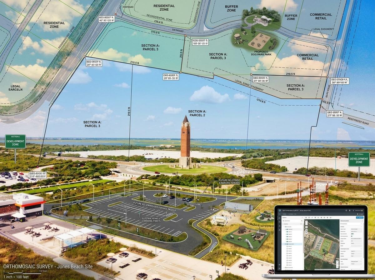
Orthomosaic drone maps simplify the complex processes of permitting and due diligence, ensuring everything runs smoothly and efficiently.
Zoning and Permitting with Drone Maps
Drone maps make zoning and permitting more straightforward by providing clear, detailed visual data. These maps help you identify zoning boundaries and understand land use regulations more easily. With this information, you can prepare more accurate applications, reducing the chance of delays. The precision of drone maps helps demonstrate compliance with local regulations, facilitating a smoother permitting process. By using these maps, you minimize the risk of oversights that could lead to costly hold-ups.
Feasibility Studies Made Simple
Conducting feasibility studies becomes more efficient with orthomosaic maps at your disposal. These maps offer reliable data that helps assess the viability of a project quickly. You can evaluate site conditions and constraints with greater accuracy, making it easier to determine project feasibility. The detailed insights provided by drone maps allow for a thorough analysis of potential challenges, helping you make informed decisions. This proactive approach ensures that you address any issues before they become problems, saving time and money in the long run.
RTK Drones and PPK Workflows
Utilizing RTK drones and PPK workflows enhances the accuracy of your mapping projects. These advanced technologies ensure your data is precise and reliable, crucial for successful real estate development. RTK and PPK systems reduce errors and increase efficiency, allowing you to complete projects faster. The high precision of these workflows ensures your maps are detailed and accurate, supporting confident decision-making. By incorporating these technologies, you position yourself at the forefront of innovation, setting your projects up for success.
Enhancing Marketing and Construction Tracking
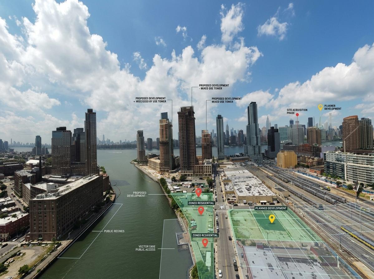
Orthomosaic drone maps provide powerful tools for both marketing and construction tracking, giving you an edge over competitors.
Property Marketing Visuals with Georeferenced Imagery
Georeferenced imagery transforms property marketing, offering stunning visuals that capture attention. These images highlight the unique features of your properties, making them stand out in listings. With georeferenced imagery, potential buyers gain a better understanding of the property’s location and surroundings. This clarity enhances buyer engagement and increases the likelihood of a sale. By showcasing properties in their real context, you provide a compelling narrative that resonates with your audience.
Construction Progress Tracking and Volumetric Measurements
Tracking construction progress is simplified with orthomosaic maps, which provide real-time data and insights. Volumetric measurements allow you to monitor material usage and site changes accurately. These maps help you identify issues early, preventing costly delays and keeping your project on schedule. By using drone maps to track progress, you maintain control over your project and ensure it stays on track. This proactive approach leads to better project management and successful outcomes.
Contour Maps and Cut and Fill Analysis
Contour maps generated from drone data offer precise topographical insights crucial for cut and fill analysis. These maps help you plan earthworks efficiently, optimizing resource use and minimizing waste. Cut and fill analysis supported by accurate contour maps ensures your project is both environmentally and economically sustainable. By leveraging this information, you make informed decisions that reduce costs and enhance project outcomes. This strategic approach boosts your project’s success and sets a new standard for efficiency.
Frequently Asked Questions
What are orthomosaic maps in real estate development?
Orthomosaic maps are detailed aerial images that provide high-resolution, accurate views of a site. They are used in real estate development to enhance planning, design, and marketing processes by offering comprehensive visual data.
How do drone maps simplify permitting?
Drone maps offer precise visual data that aid in understanding zoning boundaries and land use regulations. This clarity helps prepare accurate applications, reducing delays in the permitting process.
What role do RTK and PPK technologies play in orthomosaic mapping?
RTK and PPK technologies enhance the accuracy and reliability of orthomosaic maps. These systems reduce errors, ensuring the data collected is precise, which is vital for successful real estate projects.
How does georeferenced imagery improve property marketing?
Georeferenced imagery provides stunning visuals that highlight a property’s unique features and context. This clarity helps capture buyer attention and improves engagement, increasing the likelihood of a sale.
Why are contour maps important for real estate development?
Contour maps offer detailed topographical insights, crucial for planning earthworks and cut and fill analysis. They help optimize resource use and ensure projects are environmentally and economically sustainable.
Learn the advantages of precision mapping for your projects.