
Winter’s bare branches reveal terrain hidden all year. Spring’s thaw exposes earthwork progress with fresh clarity. Seasonal drone mapping construction captures these shifts to boost your safety, accuracy, and schedule certainty. You’ll see why year-round aerial monitoring uncovers insights no single flight can match. Let’s explore how your site benefits from every season’s unique vantage point.
Seasonal Insights for Drone Mapping
Each season offers a unique perspective for drone mapping, revealing critical site insights. Let’s explore the benefits of capturing data during winter, spring, and summer.
Winter Visibility and Precision
In winter, leaf-off conditions allow drones to capture clear views of the terrain. This is ideal for mapping dense areas where foliage might obscure important details. Without leaves, you can see the ground structures more clearly, helping to measure and monitor cut and fill volumes accurately. Snow cover, when present, can also highlight surface irregularities that might go unnoticed otherwise. These visuals enhance safety by allowing teams to identify potential hazards or areas needing attention. Aerial mapping during this season ensures that no detail is missed, providing a comprehensive overview of the site.
Spring Erosion and Drainage Checks
Spring often brings changes in soil conditions, revealing issues with erosion and drainage. Drone mapping during this time can track these shifts effectively. The thaw exposes earthwork progress and any erosion that may have occurred during the winter months. By capturing detailed images, you can assess areas requiring erosion control monitoring and make necessary adjustments before they escalate. Spring is also a prime time to evaluate drainage systems, ensuring they function correctly as snow melts and rain falls. These insights enable proactive decision-making, preventing costly repairs down the line.
Summer Progress and Safety Monitoring
Summer is the peak construction season, making it crucial to maintain continuous oversight. With drones, you can regularly document construction progress, ensuring projects stay on schedule. The clear, long days provide optimal conditions for capturing high-resolution imagery. Drones offer a bird’s-eye view, enhancing safety by identifying equipment or personnel in potentially hazardous areas. This 360-degree perspective ensures that safety protocols are followed and potential risks are mitigated before accidents occur. Consistent monitoring during this bustling period helps maintain momentum and address any issues swiftly.
Benefits of Year-Round Mapping
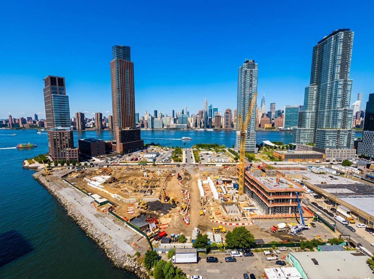
Mapping throughout the year provides a comprehensive view of your project, revealing insights that single-season snapshots miss.
Enhancing Accuracy and Safety
Year-round mapping enhances accuracy by capturing variations in the site over time. By frequently updating the site model, you reduce errors and improve precision in your planning and execution. Consistent mapping also heightens safety by regularly identifying potential hazards and allowing for timely interventions. This level of oversight not only saves time but also protects workers and equipment from unforeseen dangers.
Improving Schedule Certainty
Regular updates from drones boost schedule certainty. You can track progress against timelines, ensuring that milestones are met. By identifying delays early, you can implement corrective actions before they impact the overall timeline. This proactive approach keeps projects on track, reducing the risk of costly overruns and ensuring client satisfaction with timely delivery.
Leveraging Weather Windows
Each season presents unique weather windows ideal for certain mapping tasks. Understanding these can optimize drone deployment, ensuring data is captured at the best possible time. For example, clear winter days might be perfect for site overviews, while spring’s softer light can highlight subtle topographical changes. Using these windows strategically enhances the quality and relevance of the data collected.
Implementing a Drone Mapping Plan
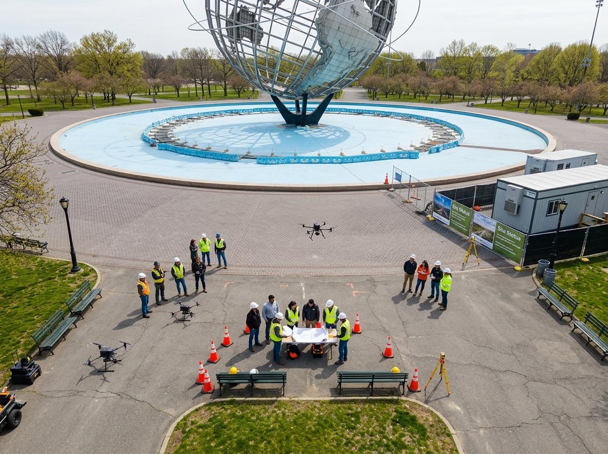
Getting started with a seasonal drone plan involves strategic planning and execution to maximize benefits.
Crafting a Seasonal Flight Calendar
Develop a flight calendar that aligns with your project’s phases and seasonal changes. Each season offers different opportunities for data collection. By scheduling flights strategically, you ensure that key insights are captured when they are most relevant. This calendar acts as a framework for consistent data collection, keeping your project on track year-round.
Customizing Deliverables for Construction Needs
Tailor deliverables to your specific construction needs. Whether you require BIM-ready deliverables or as-built verification, drones can provide the precise data you need. Customizing these outputs ensures you receive actionable insights, enhancing decision-making and project outcomes.
Consulting and Booking with DroneSpection
For those ready to explore these advantages, consulting with an expert can provide clarity and direction. DroneSpection offers tailored solutions, helping you implement a successful drone mapping strategy. Their experienced team ensures you leverage the full potential of drone technology, transforming your site management approach.
Frequently Asked Questions
Why is winter ideal for drone mapping?
Winter’s leaf-off conditions provide clear views of the terrain, allowing more precise mapping of dense areas. Without foliage, drones can capture detailed visuals of ground structures and potential hazards.
How can drones help with erosion control?
Drones track changes in soil and drainage during spring, highlighting erosion or drainage issues. This data helps you address problems early, preventing costly repairs and ensuring site stability.
What are the benefits of year-round drone mapping?
Year-round mapping improves accuracy, enhances safety, and boosts schedule certainty. Regular data updates offer comprehensive oversight, allowing proactive management of potential issues.
Capture the season’s market with stunning aerial visuals.