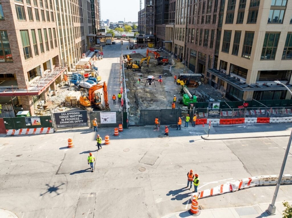
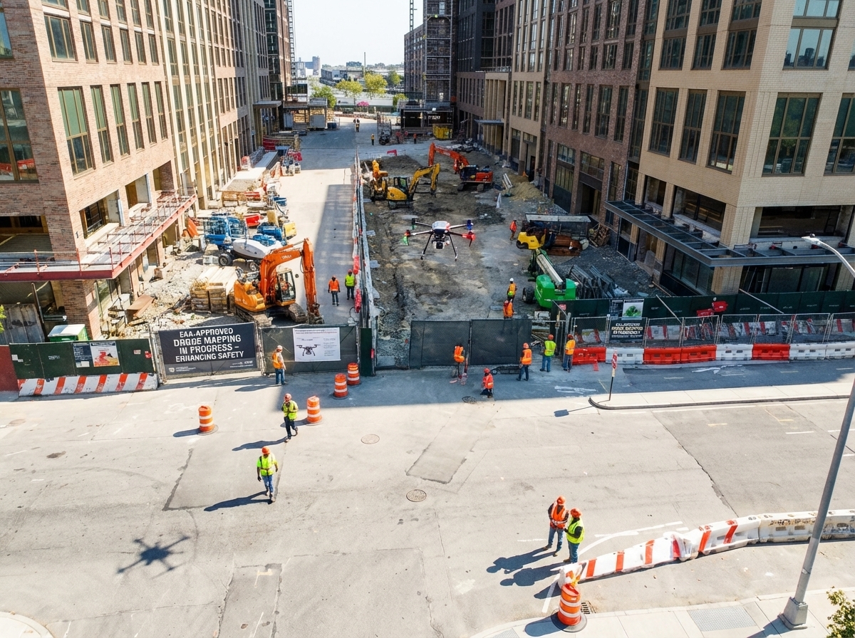
Build Safer. Move Faster. FAA-Approved Drone Mapping at Work.
Most construction sites still rely on slow, risky methods to track progress and spot hazards. That wastes time and puts your team in danger. FAA-approved drone mapping changes everything by giving you fast, precise aerial surveys that cut costs and boost safety. Ready to see how DroneSpection’s insured pilots deliver clearer site insights that keep your project moving on schedule? Learn more about drone regulations and benefits for construction here.
Enhancing Construction Safety
Construction today demands more than just hard hats and safety vests. Drone technology is reshaping how projects manage safety. By offering a bird’s-eye view, drones quickly identify risks and ensure safer work environments.
Reducing Risk with Drones
Imagine gaining a complete view of your site without setting foot on unstable ground. That’s the power of drones. They give you the ability to spot potential hazards from above, ensuring your crew stays out of harm’s way. With FAA-approved drone mapping, you gain detailed aerial images that help pinpoint issues before they escalate. Over 60% of accidents on sites are preventable with better oversight. Drones provide this oversight, keeping your team safe and your project on track.
Safety directors and superintendents can sleep easier knowing they have a reliable method to monitor every inch of their site. The longer you wait to adopt this technology, the more you risk facing costly delays and safety breaches. Take action now: let drones be your eyes in the sky.
Identifying Hazards from Above
Spotting hazards early can prevent significant problems down the line. Drones offer unparalleled visibility, capturing even the smallest details from above. They can identify loose scaffolding, improper storage, or other risks that might be missed from the ground. With high-resolution imagery, you can make informed decisions swiftly without compromising safety.
Most people assume traditional methods are enough. But think about the time and resources spent on manual inspections. Drones change the game. They cover large areas in minutes, providing comprehensive data that enhances site safety. Curious about the benefits? Discover more here.
Boosting Efficiency on Site
Beyond safety, drones also streamline operations. They offer construction managers a powerful tool to accelerate timelines and maintain budgets. With precise mapping, projects not only move faster but also smarter.
Accelerating Project Schedules
Time is money, especially in construction. Drones can drastically cut the time spent on surveys and inspections. Picture this: projects that once took weeks to assess can now be done in days. Studies show using drones can speed up surveying processes by up to 70%. This means your project stays ahead of schedule, reducing the risk of costly delays.
When you leverage drone technology, you shift the focus from routine checks to proactive planning. Faster data collection means quicker decision-making, keeping your project seamlessly on track. Ready to see this transformation in action? Explore case studies.
Cost Control with Precision Mapping
Precision is the name of the game when it comes to budget management. Drones offer accurate, real-time data that traditional methods struggle to provide. By using orthomosaic mapping and 3D drone modeling, you gain insights that help avoid unnecessary expenses.
Consider the savings: eliminating errors in cut and fill calculations, stockpile measurements, and volumetric analysis can collectively save thousands. Drones deliver this precision, ensuring you only move what’s needed, optimizing resources efficiently. Why accept mistakes when accuracy is within reach? Learn how drones enhance cost efficiency.
DroneSpection: Your Trusted Partner

Choosing the right partner makes all the difference. DroneSpection stands out with its FAA-certified pilots and advanced mapping solutions. We’re not just about technology; we’re about transforming your project’s potential.
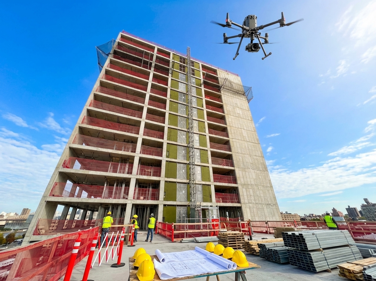
FAA-Certified Drone Pilots
Our pilots are more than just operators; they’re experts. FAA certification ensures they adhere to the highest safety and operational standards. With DroneSpection, you’re guaranteed professional service and peace of mind. In an industry where safety is paramount, our pilots lead with experience and precision.
Why settle for less when you can have the best? Let our pilots deliver the aerial insights your project needs. Discover the difference with DroneSpection and elevate your construction approach.
High-Precision Mapping Solutions
Every project deserves precision. Our mapping solutions include drone photogrammetry, RTK PPK accuracy, and ground control points, ensuring every inch of your site is accounted for. This level of detail allows for reliable as-built verification and site logistics planning.
Whether it’s hazard identification or Procore documentation, our UAV mapping services provide the clarity and confidence you need. Join the ranks of forward-thinking construction leaders who trust DroneSpection to enhance their site visibility and efficiency. Ready to redefine your construction strategy? Explore FAA drone operations and see the future in action.
Explore custom drone solutions that turn challenges into opportunities.