From Sky to Site: The Complete Guide to Drone Mapping and Orthomosaics for Construction Progress
Forget the old guesswork of tracking construction progress. You’re juggling tight schedules, complex sites, and mounting pressure to prove every milestone. Drone mapping and orthomosaic technology give you precise, up-to-date views that cut through the noise—so you see exactly what’s built and what’s next. In this guide, you’ll learn how to harness these tools for reliable construction progress tracking, backed by FAA-certified expertise you can trust. For more information, check out this in-depth guide to drone-based orthomosaic maps.
Understanding Drone Mapping
Drone mapping is revolutionizing how construction projects are monitored, offering a bird’s-eye view of every corner of your site. It combines cutting-edge technology with practical applications to ensure your work stays on track.
Drone Mapping Basics
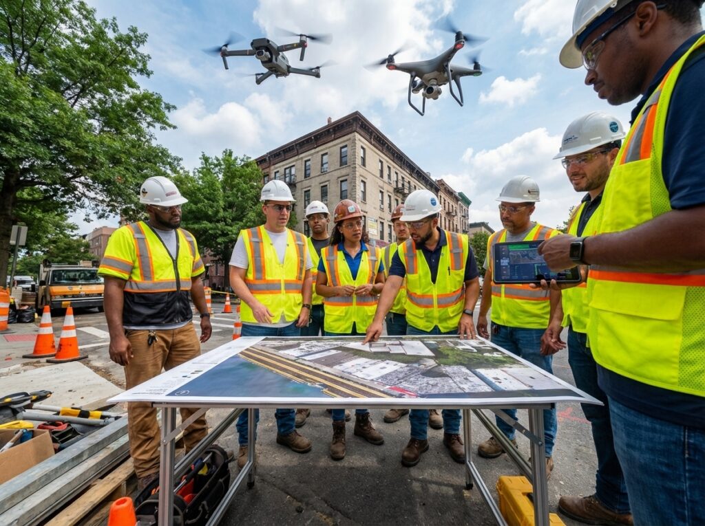
Imagine having a detailed map of your construction site made in a fraction of the time it takes with traditional methods. That’s the power of drone mapping. By using drones equipped with high-resolution cameras, you can capture comprehensive images that are then stitched together to create a full map. This technology provides you with accurate data, helping you make informed decisions quickly. For more information on the software used in this process, see this software guide.
Here’s the key insight: you get real-time information that’s crucial for daily operations. The precision of drone mapping is ideal for tracking site progress or identifying potential issues early. Most people think traditional surveys are the only option, but drones are changing that narrative. They offer not just speed, but also safety, as drones can access hard-to-reach areas without putting anyone at risk.
Orthomosaics in Construction
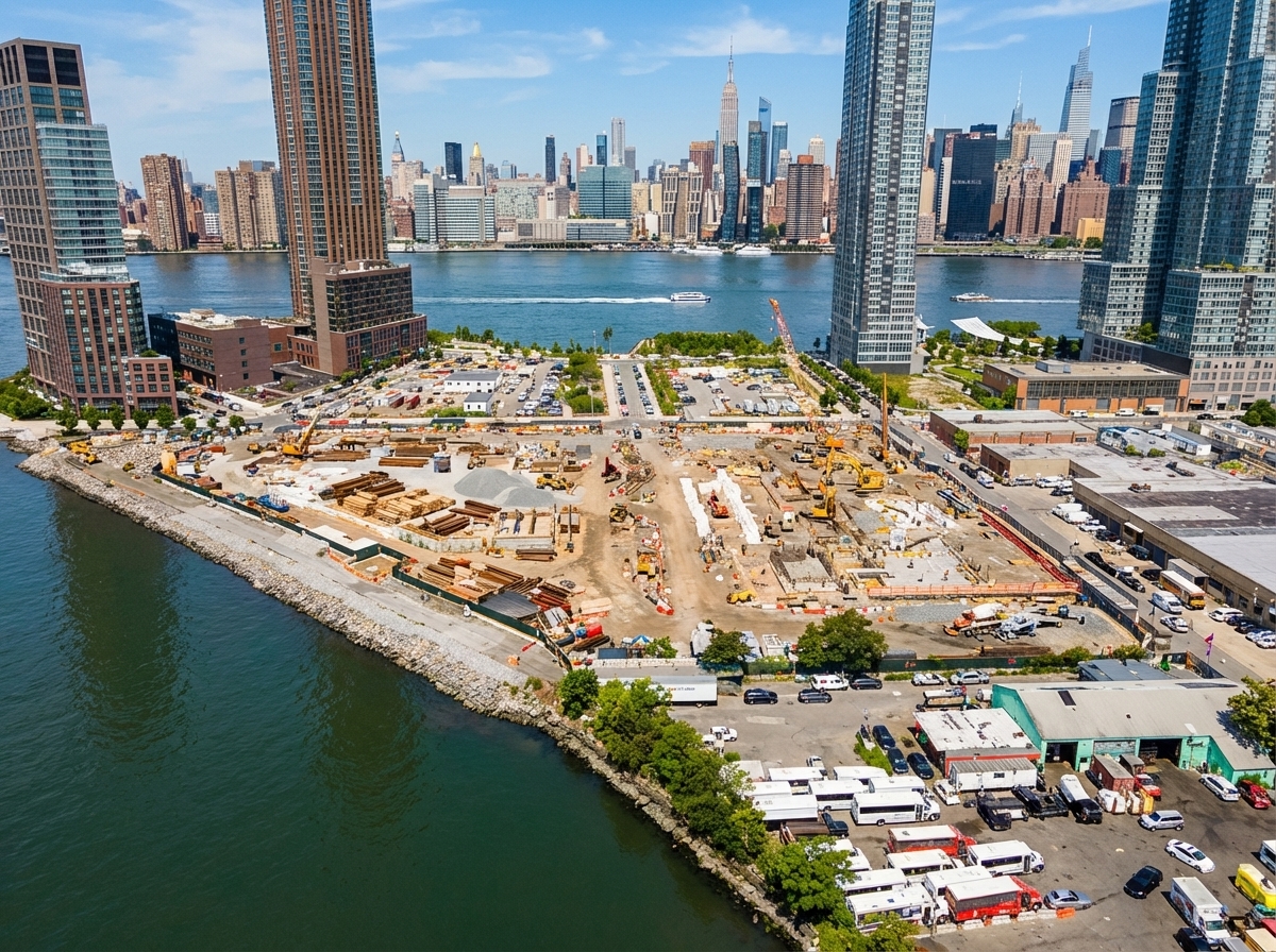
Orthomosaics are like a magic lens for construction sites, enabling you to see the entirety of your project with clarity and detail. These maps are created by combining multiple aerial images into one seamless picture, correcting for any distortions or angles. This means you get a true-to-scale representation of your site, which is crucial for precise planning and assessment. If you’re interested in a detailed checklist for orthomosaic mapping, visit this resource.
The benefit here is huge: orthomosaics allow for accurate measurements and data analysis, whether it’s for volumetric analysis or cut and fill calculations. They’re invaluable when you need to verify construction elements or prepare for future phases. While some might rely on rough estimations, these maps provide you with the exact data needed to keep your project moving forward efficiently.
Workflow and Accuracy Standards

Understanding the workflow and accuracy standards of drone mapping ensures you’re getting the most reliable data possible. Knowing the processes involved can improve the way you handle construction progress tracking.
RTK Drone and PPK Workflow
RTK (Real-Time Kinematic) and PPK (Post Processed Kinematic) workflows are essential in achieving precise results. RTK drones offer real-time data correction, enabling you to make swift, informed decisions on-site. On the other hand, PPK provides even greater accuracy by processing data after the drone flight, correcting any discrepancies. This dual approach ensures you have the most accurate information at your fingertips for critical decision-making.
Think of the RTK and PPK as your project’s eyes in the sky. You get real-time updates with RTK, while PPK guarantees the highest level of precision. The longer you wait to implement these technologies, the more you risk inaccuracies impacting your project. They are not just tools, but essential components in modern construction management.
Importance of Ground Control Points
Ground control points (GCPs) are the unsung heroes of drone mapping, providing the reference needed for accurate geospatial data. By placing these points strategically around your site, you ensure that the aerial images captured align perfectly with the real-world coordinates. This is crucial for maintaining the integrity of your maps and ensuring every measurement is spot on.
Without GCPs, your maps could be off by several feet, leading to costly errors. Most people overlook their importance, but they’re a cornerstone of reliable mapping. By integrating GCPs into your workflow, you enhance the accuracy and trustworthiness of your data. Learn more about how GCPs can enhance your mapping projects through this discussion.
Deliverables and Integrations
The deliverables and integrations offered by drone mapping streamline construction management, providing valuable insights and enhancing overall productivity.
2D Site Mapping and 3D Point Cloud
2D site mapping allows you to visualize your entire project area with incredible detail. It’s perfect for planning, monitoring, and documenting progress. Meanwhile, 3D point clouds give you an intricate model of the site, enabling you to see every nook and cranny with precision. These deliverables help you make informed decisions faster, reducing the likelihood of costly mistakes.
Consider the impact: with a full 3D model, you can conduct volumetric analysis, adjust plans based on real-time data, and verify construction phases with ease. This level of insight transforms how you approach project management, turning potential obstacles into opportunities for optimization.
BIM, Procore, and Autodesk Integration
Integrating drone data with platforms like BIM, Procore, and Autodesk Construction Cloud takes your project management to the next level. These integrations allow you to seamlessly incorporate accurate georeferenced imagery and as-built documentation into your workflow. This not only improves coordination but also enhances collaboration among team members.
With these integrations, you can track change detection, ensure compliance, and maintain a clear line of sight on project progress. The synergy between drone data and construction software creates a more cohesive, informed working environment. Embrace these tools and watch your efficiency soar.
By understanding and utilizing these advanced drone mapping techniques and integrations, you position yourself at the forefront of construction management. This comprehensive approach ensures that every aspect of your project is meticulously documented and optimized for success.
Nice.